
Authors: Renne Tergujeff and Jukka Miettinen
The summer holiday season starts to be over, and we are entering the final three months of the Forest Carbon Monitoring (FCM) project. Publication of the FCM tools is one of the main objectives for the remaining time.
You may have seen the term Forestry TEP mentioned several times on the FCM website. It is the processing platform where the FCM use case demonstrations have been run. It will also be the main interface to access the FCM tools after the project has ended. Therefore, we thought that this would be a good moment to introduce the platform to those who are not yet familiar with it.
The Forestry Thematic Exploitation Platform (Forestry TEP, or shortly F-TEP) is an online environment designed for efficient utilization of satellite data in forest analysis tasks. Integration of the FCM tools into this platform allows users to also benefit from the large amount of supporting tools available on the platform, or to create their own tools for further processing of the FCM output products.
Forestry TEP enables the processing of continuously updated current and archived satellite data, including the global optical and radar data from the Copernicus Sentinel satellite instruments. Users can upload their own data as well, and access to hosted VHR data can be arranged by request. A selection of data processing services is available, and popular tools such as QGIS and ESA SNAP can also be used on the platform. The platform is hosted on the CREODIAS cloud computing and data provision infrastructure that is a central element of the Copernicus Data Space Ecosystem.
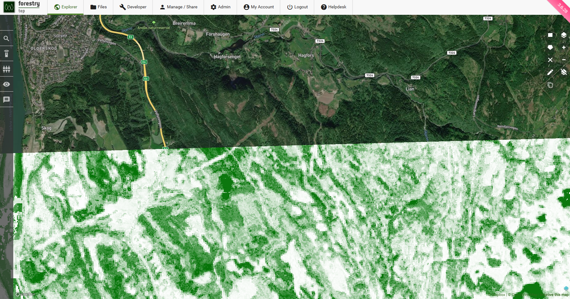
Screen shot from the Forestry TEP platform, visualizing growing stock volume map produced with a k-Nearest Neighbour tool.
Apart from using the online user interface, all the platform features and processing services can be accessed from external systems via the Forestry TEP API interface or a client-side Python library. For researchers and value-adding service providers, Forestry TEP offers a powerful online application development environment based on Linux and Docker. Developers can craft their software using any programming language and build them online to produce processing services that exploit the data and tools available on the platform. An extended data catalogue is available in service development, including digital elevation models (DEMs), Copernicus Land Monitoring Service (CLMS) data and more. The developers can also link their services to access externally hosted datasets.
Platform development is ongoing a major architectural revision on the basis of the Earth Observation Exploitation Platform Common Architecture (EOEPCA). This includes a new processing service concept and developer tooling, based on the OGC Best Practice for Earth Observation Application Package. While the development is being finalised, selected subscription options already include access to a beta release of the new offering.
More information on how to access the FCM tools on the Forestry TEP platform will be distributed in the coming months. Note that the platform is also part of the ESA Network of Resources (NoR), allowing to apply for NoR sponsoring for the use of the FCM tools and other platform services. While waiting for the FCM tools to be finalized and publicly released, you can already familiarize yourself with the Forestry TEP platform.